 "It all begins with the Map!"
GeoElections News
 Temple Terrace, FL www.icwmaps.com VOL. 6 NO.1 -
  $.50
$.50 
|
MapInfo to TIGER Translator© (TMT) The ICW TIGER to MapInfo Translator© (TMT) was first introduced in 1992 and designed to work from a DOS prompt. TMT© was originally written in Clipper and MapInfo, Corp. was the first one in line to purchase the product. This is ancient history. Roll forward to 1998 and ICW introduced UTT© written in C++ and MapBasic which facilitated the convenience of speed and an interface that operated from within the MI Pro environment. UTT© was backward compatible to the 1995 TIGERs and working forward through the 2006 2nd Edition TIGERs. TIGER/Line Shapefiles introduced in 2008 represent a new generation of data formats that demand a new translator. The people at ICW have responded with a new version with a name that harkens back to the 1990’s and a user interface designed to endure the next decade, TMT©. The fastest, easiest and most powerful TIGER/Line File translator we have ever built. The people at ICW are proud to offer you TMT©.

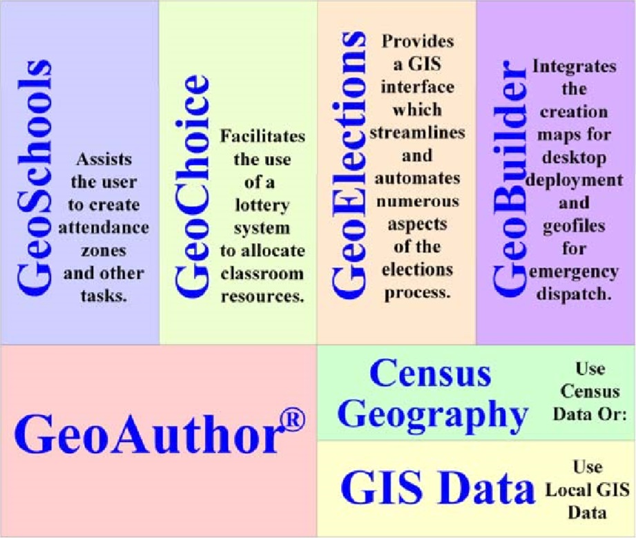
Introducing GeoAuthor® 2.0 ICW introduced GeoAuthor® 2.0 at the National Council of State Legislatures (NCSL) Spring Forum in Washington D.C. to a welcoming audience. While numerous special interest groups attended the Spring Forum, the Elections and Redistricting group was the primary audience. GeoAuthor® is designed to provide the user with an easy-to-use set of tools with which to create a project for a county using TIGER/Line Shapefiles provided by the US Bureau of the “Census products have always been extremely valuable to a diverse audience private and public sector decision makers. Since 1995 ICW has delivered an easy-to-use and well structured means to economically update and enhance TIGER\Line geography making it suitable for expanded use in decision support systems,” said Ken Tozier CEO of ICW. “One can have over 40 layers of enhanced geographic data produced by GeoAuthor®.” |

With the merger of MapInfo and Group 1 software into a single division of Pitney Bowes, Inc., Tuesday, January 27, 2009, the new name officially becomes Pitney Bowes Business Insight (PBBI) which is dedicated to supporting a Partner Program to bring the best in class of vertical integration of PBBI applications to address your most important business issues inclusive of both the private and public sectors. As valued clients, you can be assured that PBBI is dedicated to delivering the same quality solutions and expert advice you have come to expect from MapInfo, Group 1 Software and their channel partners who offer a wealth of vertical solutions such as International Computer Works, Inc. (ICW) with their integrated solution for elections, GeoElections®.
Your relationship is important to us. As Pitney Bowes Business Insight, we're ready to help you implement solutions you meet your needs, connect with your customers whether they are in the private or public sectors |
|
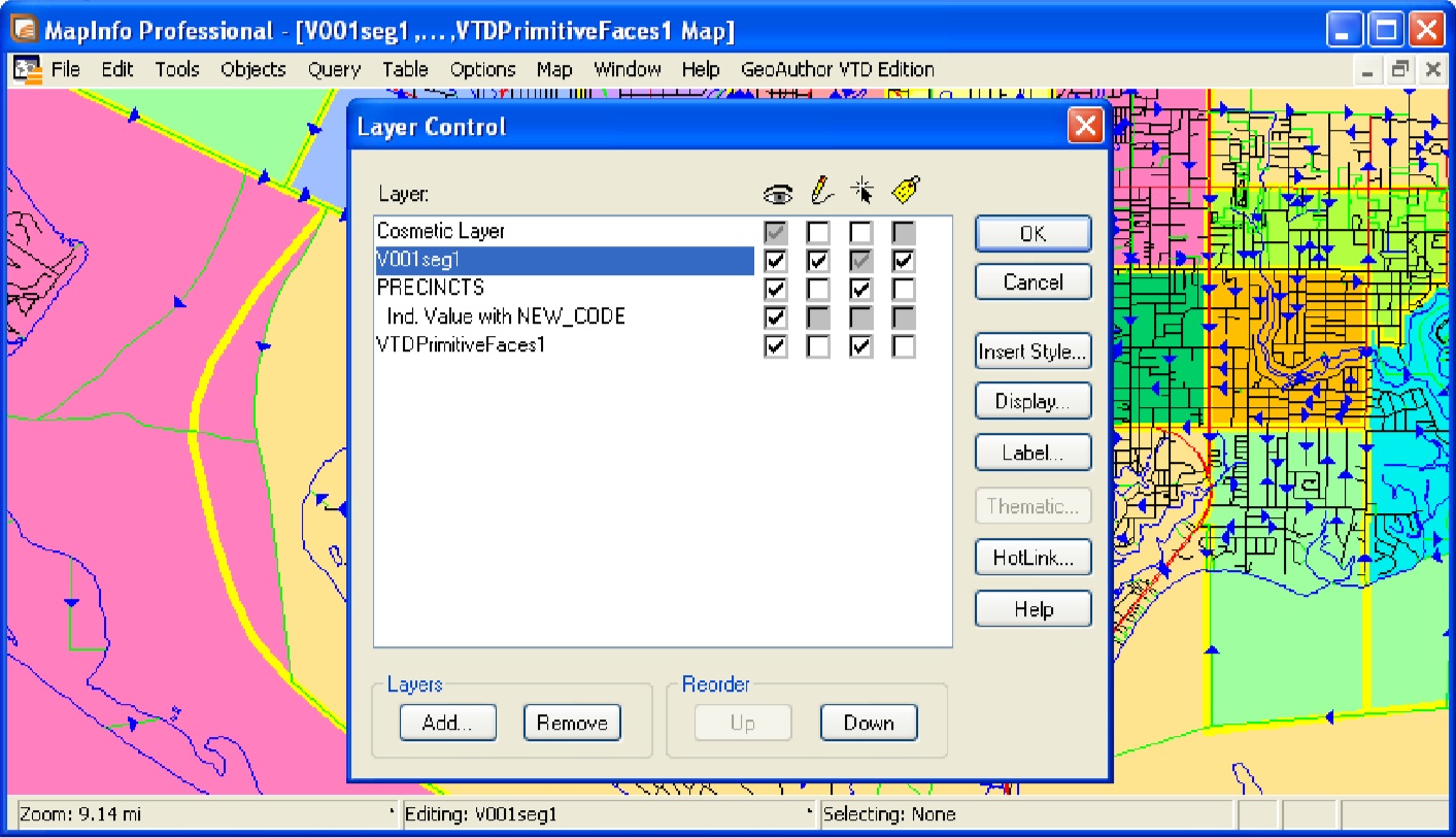
GeoAuthor VTD Update Assists In Florida ICW introduced GeoAuthor VTD Edition at the 7th Annual GeoElections Conference in November 2008. Designed to assist clients with participation in the VTD Update Phase for Redistricting 2010, this also gave our clients an opportunity to preview the next generation of editing tools from ICW.
Congratulations Florida! GeoAuthor® |


 The combination of MapInfo's award-winning location intelligence and predictive analytic solutions and Group 1's renowned operational intelligence and communication management solutions provides even more ways to benefit from the rich set of diverse solutions that comprise the product lines of both PBBI and ICW: