 "It all begins with the Map!"
GeoElections News
 Temple Terrace, FL www.icwmaps.com VOL. 6 NO.2 -
  $.50
$.50 
|
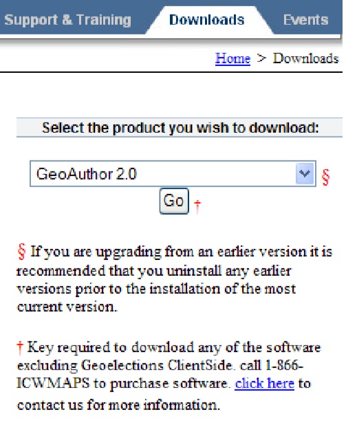
“Redirect our Energy, Revitalize our World” is the theme for the 38th year of the International Association of Clerks, Recorders, Election Officials and Treasurers. The Spokane Fire Department has been using ICW mapping software to interface with their CAD since 2002. NEWSMAKER Down Load Latest Version To ensure you are always working with the latest version of software go to the About dialog box and check the version and/or build number. Then go to www.icwmaps.com and check out the download page to compare versions.
If you need to update to the most current version, simply follow the instructions printed on the screen which includes calling for help when in need. ICW Introduced Web Based Election Results Reporting With Interactive Precinct Maps GeoElections® receives a new feature enhancement with a web based election results reporting module featuring interactive precincts maps that can be published election night and/or used for archiving results. Introduced at the Florida Association of Supervisor of Elections (FSASE) Summer Conference 2009 held in St. Augustine, Florida, over 40 (forty) elections officials participated in the product design exercise. They watched live demonstrations, provided feature recommendations on preprinted forms which also sought their input on the benefits associated with inclusion of their feature recommendations.
Designed to provide the staff with an easy-to-use set of tools with which to publish voting results tabulated with software from Premier Elections Solutions GEMS®, ES&S UNITY and WinEDS from Sequoia Voting Systems. The data from these three tabulation reporting systems is linked to interactive precinct maps built with GeoElections® and included in additional reports that are likely more common amongst election night reporting systems. The most significant feature that differentiates the GeoElections® offering from other election night reporting systems is the means of accessing results via interactive precinct maps. The voter can simply point and click at a precinct in the map and obtain the results to date for a precinct. The user can change views with zoom in and out, pan and scroll and auto-center the map. The GeoElections® system can report tabulation progress precinct by precinct as the results come in to the elections office and is designed with an auto-refresh feature for the viewing community. Additionally, more traditional reports are also available by race, referendum, contest or issue: County Wide Summaries both static and auto-scrolling, Total Vote By Type Cast with bar charts (early votes, absentee, election day, over seas, etc.). These reports are available reflective of the information provided by the tabulation software used in any respective county. |
|
GeoElections Training Class Followed Ohio Secretary of State Jennifer Brunner’s Summer Elections Conference In Columbus June 18th and 19th
A GeoElections® training class was conducted following Secretary of State Jennifer Brunner’s Summer Elections Conference. The training classes were conducted on Thursday 9:00 AM to 5:00 PM and Friday 9:00 AM to 2:00PM. Topics covered included an Overview of MapInfo Professional and the GeoElections Architecture, Editing with MapInfo and the MapEdit Toolkit, Defining Jurisdictional Boundaries and Reprecincting, with additional topics including How To Use MapMaker and GeoPackager. Over 20 people attended from across the State. Both small and large counties were represented. GeoElections interoperates with voter registration systems and of the counties in attendance, four different voter registration systems are used. |
|
MapInfo Professional Version 10.0 Was Released June 23, 2009 The latest version of Pitney Bowes Business Insight's application for business mapping and analysis, MapInfo Professional Version 10.0 is now available. This includes Concurrent and Single User Licenses, a new feature offering. This powerful and user-friendly mapping and location analysis tool has just been made even better! Benefits of MapInfo Professional Version 10.0 include: •Greater Ease of Use - A more intuitive user interface including a newly designed layer control dialog box and data sharing via layered PDF enables organizations to more easily and efficiently create and share customized maps, resulting in greater efficiency and time savings. •Cost Savings - MapInfo Professional 10.0 includes PostGIS, an open-source database, providing users with a cost-effective open source alternative. • Enhanced Data Access - Organizations can tap into even more data including Microsoft SQL Server 2008, giving organizations even greater flexibility and continuing access to multiple forms of data. •Concurrent User Licenses - MapInfo Professional may also be licensed on a Concurrent User basis. A Concurrent User License allows for an unlimited number of installs of the Product by the Licensee, but limits the number of users who can simultaneously access the Product to no more than the number of Concurrent User Licenses purchased. •Upgrades Available - Customers may Upgrade as far back as version v8.5. If you have a copy older than v8.5, you must purchase a "new" license not an upgrade. This solution enables multiple departments throughout organizations to access and analyze data. Version 10.0 enables users, regardless of their IT skill level, to more quickly create desired maps for improved decision making and public consumption. The ability to customize the user interface also gives employees greater flexibility when creating maps. All of which enhances the user productivity of GeoElections®. |